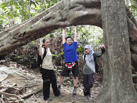
 Background: Gunung Datuk (or Gunung Dato') is part of the Hutan Lipur Gunung Datuk (forest) in Rembau, Negeri Sembilan.
The summit is at 2,900 feet above sea level, with hiking difficulty at upper intermediate level. The terrains were similar to those at Kinabalu, at least a quarter part of it so for folks who are practicing to climb Malaysia's highest peak, you should find some time to come here.
Stories were told, and even inscribed on the sign board at the entrance that the mountain was once the venue where the Ketua-ketua Adat (Customs Leaders of Adat Perpatih) used to meet and announce the name of future Dato' Lembaga (Clan Chief). Hence the name Gunung Datuk. Anyhow, you can very well read the introduction of Gunung Datuk as shown in the shot above.
How to get there: Gunung Datuk is situated within Gadung, in-between the towns of Rembau and Tampin. Coming from PLUS Highway, you can either opt for exit at Pedas/Linggi or Simpang Empat toll plaza. From there, just follow the available signs along the trunk road. Maintain your direction towards Pekan Kota before reaching the nearby villages.
Note: There is a RM5 fee for hikers. Other fees apply for camping, booking the chalet, etc. Parking is free within the compound.
I haven't been here since 2009. This was my first hike of the year, after many months of travelling and meager workouts. Furthermore, this outing was soon after Hari Raya Aidilfiri (aka Eid Mubarak). Imagine my lousy fitness condition on the day!
The drive from KL to Nilai (for breakfast) and later to Rembau took about close to 2 hours. I was counting on the hike to burn off all those raya food plus the 'nasi lemak ayam goreng' I just had at the Nilai R&R. We warmed up with some photo-taking before embarking on the hike. Gotta hike up the spirits too, y'all!
 And then the gruelling hike began....I don't mean to scare off people from coming here, but this Gunung Datuk posed it's own unique challenges. The first part of the hike was kind of steep, built and stacked with big tree roots and rocks. It would be good to bring a hiking pole along. As for us, we picked up some sticks left behind by previous hikers. God bless their good souls!
  We took a break upon reaching the first checkpoint. After that, the hike was relatively easier. You could ditch the climbing sticks, if you want. Slightly less rocky and more greens were visible. It was raining the night before our climb, and yet the bottom part of the forest was as dry as it could be. That should help to describe the thickness of the forest, or the distance/height from the summit.
  Only towards the later part of the climb did we sight puddles of water and mud. Still, there were many big trees and big rocks to go by. Just so you know, the second leg of the hike covered more distance and therefore took longer time than the first leg.
Alas the spaceship rock, indicating the near distance to the summit...
Last climb...
Note: Just a word of advice from me, the last leg to the summit isn't for the faint-hearted nor acrophobic ones. The ladders were of limited width, and it would be a steep ascend. The risk is high, so please don't push yourselves to go more than you can.
For those who'd make it...lovely feeling at the top...with a magnificent view of the Straits of Malacca :D
Be careful when descending...coz you know how steeep it was climbing up just before. Ensure safety at all times!


Wow.. Thanks for your very informative blog!!
ReplyDelete